

Eight years ago, a film appeared declaring that there are no forests and that we describe as ‘forests’ today are just collections of tree-like shrubs. All this in relation to the view that what are presented to us as ‘Table Top Mountains’ or ‘Mesas’ (the Spanish for ‘table’) are in fact simply ancient trees, severed at their base. And, the video pulled no punches in arguing that all mountains are the remnants of trees and not ‘rock’ formations.
This thinking would shake the foundations not just of geology but all that mainstream knowledge teaches us about human origins, the age of the earth and – horror of horrors – whether the earth is flat or not, Why this last point? Well, some of the ‘Table Mountains’ are 3 -19 kilometres in diameter and with a ratio of stump to tree height of 1:2 – 1:9 these trees would have soared 60 – 380 kilometres in height. Clearly, it would be impossible for a globe earth hurtling through space at 1,674 kilometers (1,040 miles) per hour at the Equator, to be encumbered by trees of such gigantic proportions.
Before dismissing this as ‘Conspiracy Theory’, let’s use a skill with the same starting letters, ‘C’ and ‘T’, Critical Thinking, to see what we know about these formations. We will begin by looking at a sample of these ‘Table Mountains’ and then go on to discover what we can glean from ancient sources that might shed light on the view that these ‘Mesas’ are in fact the stumps of giant trees. We will take a look at eight of these Table Top mountains, and include in our tour d’horizon, a couple of buttes as well (there are more vertical structures). Then stay with us for a second article while we see what light ancient sources shed on this.
Table Mountains and Buttes 1. Jugurtha Tableland is located in Tunisia and can be found at the country’s border with Algeria. Its dimensions are 1.5kms (4,900 ft) long and 0.5km (1,600 ft) wide. Take at good look at the rounded markings on the flat surface, and ask yourselves what these resemble?
Do the rounded lines remind you of the markings on sawn wood, of which this is an example:
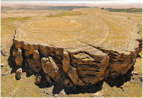
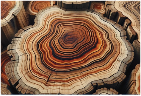
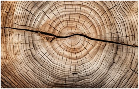
The resemblance appears to be pretty similar, suggesting that Jugurtha Tableland may be the stump of a giant tree. Despite this obvious similarity, the system has presented an extremely convoluted – and perhaps contrived – explanation for what we see. What we are told is that this structure “is an inverted relief and that millions of years ago, the hard limestone top of the mesa was actually the bottom of a valley. That, over the years, the softer surrounding hills were worn away by erosion, leaving the Tableland – and former low point – as the highest point on a plain”.
Does this explanation appear plausible to you? Let us meanwhile move on to the next example.
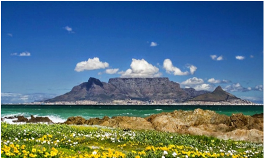
2.Table Top mountain, Capetown. This structure, dominating the landscape, is 3 km in diameter and were the diameter to height ratio be that of ceder trees, descendants perhaps of the ancient cedar tree that dates back 50 -60 million years, then the diamenter to height ratio would be 1:9, creating the remains of a tree 26km high. If the tree was related to the Combretum micranthum, a tree used in folk medicine, then the D-H ratio would be 1:2, giving this tree an original height of 6 km. Of course, without knowing the species of tree, we can only guess at its height but it is hard to conceive that it could have been under 6kms.
3.Devil’s Tower, Wyoming. This lies 100 miles northwest of Rapid City and really does resemble a felled tree with a top that ‘is almost flat’ . The ‘no forests’ video states that this would have been a tree 6km in height.
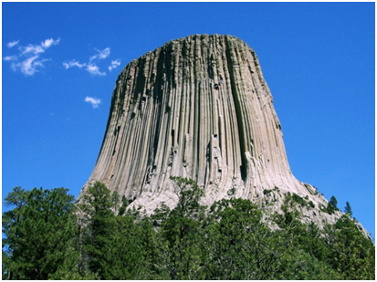
By contrast, geologists claim that it was formed from magma beneath the earth’s surface, with the Encyclopedia Brittanica stating that the tower probably formed when molten rock, pushing upward, encountered a hard rock layer and was forced to spread into a flat-topped shape. Frankly, these explanations appear implausible since they take no account of the fact of the hexagonal shape of the cells, or the fact that scientists found the root system coming out from the structure stretched out for miles in every direction. Nor do they take account of the fact that the columns curve as they reach they ground, something characteristics of the roots of trees.
You can find numerous other explanations for this structure in the information provided by the National Park Service , none of which takes account of these most basic of facts.
4.Uluru, also known as ‘Ayers Rock’, is situated near the centre of Australia in the southern part of the Northern Territory, 335 km (208 miles) south-west of Alice Springs. It lies in the Great Western Desert close to the geographic centre of Australia and was named in 1873 in honour of the Chief Secretary of South Australia, Sir Henry Ayers and when restored to the Aboriginal people, was renamed ‘Uluru’. Its circumferance measures 8 km (5 miles) and it runs 2.2 miles (3.6 km) in length. What is more, it extends 2.5 km (1.5 miles) into the ground.
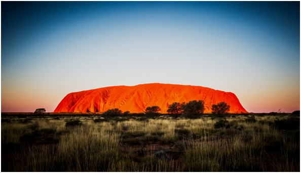
According to the International Commission on Geoheritage, this is a ‘massive inselberg’ (literally meaning an “Island Mountain”) consisting of ‘bedded sandstone …. a prominent isolated residual knob that rises abruptly from and surrounded by extensive flat lowlands.’ Elsewhere, it is described as ‘an isolated remnant left after the slow erosion of the original ancient mountain range.’
Will these explanations wash when subjected to evidence-based Critical Thinking? The less than flat top may predispose people away from viewing this as a massive tree stump but sight of the nearby Mount Conner, a massive 5kms long by 4kms wide, makes this less easy. Not only does this have a flat top but an arial view of this horseshoe-shaped structure (see the second photo below) permits you to spot radiating structures resembling toots.
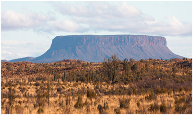
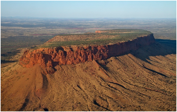
Does this aerial shot not closely resemble a tree stump with a segment of the stump missing? Well, let us move on now to perhaps the most surprising of places in which to find an ancient tree stump, Antartica.
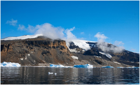
5.Brown Bluff Located at the northern tip of the Antarctic Peninsula, Brown Bluff is an ice-capped, flat topped 745 metre (2,444 ft) structure of a reddish-brown colour. Were this to have been a tree stump, we would need to accept that ‘climate change’ is not man-made but an essential part of the history of this earthly realm.
6.Mount Roraima, Venezuela
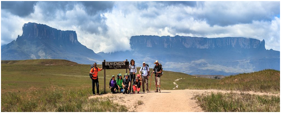
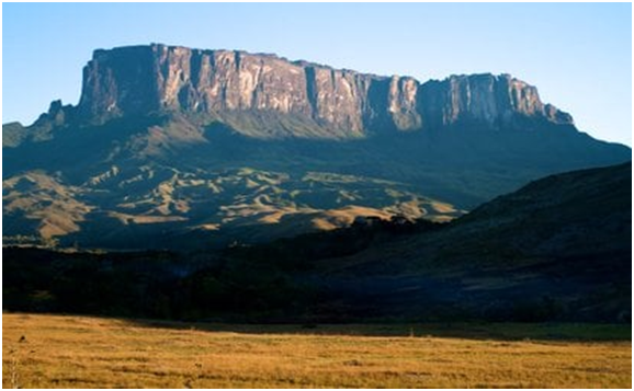
This was first described in Western sources by the English explorer Sir Walter Raleigh in 1596 but was long known to the Pemon, the local Indigenous people who believe that formations like this (‘tepuis’) are sacred, and that Mount Roraima is the stump of a supernatural tree holding all the fruit and vegetables of the world until a mythical figure. Makunaima, felled it. As remarkable as ‘Mount Roraima’ is, it is one of more than a hundred in Venezuela and western Guyana.
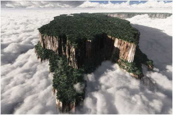
The official explanation? According to the Geological Society of London, tepuis are the remnants of a huge block of sandstone that formed in this region around 1.8 billion years ago as large sand dunes slowly solidified into rock. We have to ask ourselves whether we are more inclined to go with the official explanation or follow the lead of our eyes which shows us a felled tree (the birds eye view immediately below makes this somewhat apparent), with, possibly another severed tree besides it.
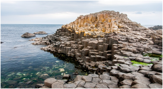
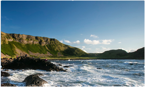
7.Giant Causeway, N Ireland Situated on the north coast in County Antrim, this structure is made up of about 40,000 interlocking basalt columns, most of them shaped like hexagons. In fact, the pattern in the basalt columns closely mirrors the microscopic patterns in plant tissues.
Despite these points, the official account, including that of the British Archaeological Survey, this site was formed by ‘cataclysmic volcanic activity’, the effect of which was that ‘lava poured out onto the existing landscape, extending from the volcanoes and fissures that littered the area and covering the entire land surface..
This explanation, favoured also by the Smithsonian, fails to account for the vast number of hexagonal columns, features that are suggestive of plant life. So perhaps legend takes us closer to the truth in ascribing responsibility for its creation to the giant, Fionn mac Cumbhaill (Finn McCool) who, challenged to a fight by a Scottish giant, Benandonner, built a path of stones (the causeway) so that they could fight face-to-face. Perhaps the involvement of a giant was transposed from being witnesses to a giant tree formation,
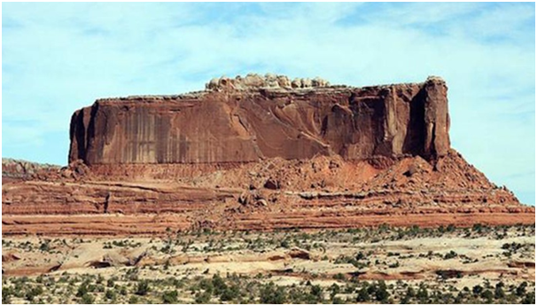
8.Canyonlands, Utah Known as ‘The Island in the Sky’, and running between the Colorado River (to the east), and Green River (to the west), it features a broad and level ‘mesa’ running 12 miles (19km) in length. So, using the minimum diameter to height ratio of 1:2, were this to have originally been a tree it would have risen an incredible 24 miles in height, and 72 miles in height assuming the modest ratio of 1:5.
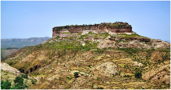
9.Debre Damo, Ethiopia Located in the north of the country, this is a flat-topped mountain with a 6th century monastery located on the top.
Conclusions
We need to consider whether these extraordinary structures have the causes put forward by official sources or whether they may actually, extraordinary though this may appear to be, constitute the stumps of gigantic ancient trees. In the next article we move on to some of the history that may support this second view.
